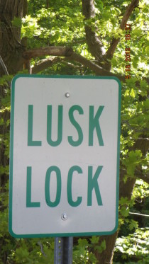
Lusk Lock Park
Access from Middle Beaver Road, Lisbon, OH 44432
The start of this section is from Lusk Lock, a part of Beaver Creek State Park located about 5 miles from the main body of the park. To get to Lusk Lock get off route 11 at the route 154 exit and head east towards Elkton. Just past the Elkton post office (on the left), route 154 turns to the left. Go straight here, down CR 419 and continue about 3 miles or so. There is a state park sign saying Lusk Lock on the right side of the road by a narrow gravel drive. Turn here and follow the drive till it ends at the parking area. The easiest access to the creek is down the trail leading out of the parking area to the left. Note that it may be possible to extend this section upstream by putting in where the creek goes under route 11.
The take-out at the State Park can be reached by turning to the right when leaving Lusk Lock and continuing down CR419 till you reach the stop sign at route 7. Turn to
the right onto route 7 south, and continue about a mile. Turn to the left up a steep hill at the intersection with the brown and white state park sign pointing towards camping. Follow this road up
the hill, past the campground on the right, and another mile or so till it comes to a stop sign. Turn to the right at the stop sign, following the gravel road back down the hill.
The start of this section is from Lusk Lock, a part of Beaver Creek State Park located about 5 miles from the main body of the park. To get to Lusk Lock get off route 11
at the route 154 exit and head east towards Elkton. Just past the Elkton post office (on the left), route 154 turns to the left. Go straight here, down CR 419 and continue about 3 miles or so. There
is a brown state park sign saying ?Lusk Lock? on the right side of the road by a narrow gravel drive. Turn here and follow the drive till it ends at the parking area. The easiest access to the creek
is down the trail leading out of the parking area to the left. Note that it may be possible to extend this section upstream by putting in where the creek goes under route 11.
The take-out at the State Park can be reached by turning to the right when leaving Lusk Lock and continuing down CR419 till you reach the stop sign at route 7. Turn to
the right onto route 7 south, and continue about a mile. Turn to the left up a steep hill at the intersection with the brown and white state park sign pointing towards camping. Follow this road up
the hill, past the campground on the right, and another mile or so till it comes to a stop sign. Turn to the right at the stop sign, following the gravel road back down the hill. The state park is
immediately across the bridge at the bottom, with the painted on gauge on the far side of the bridge, left hand side. There is parking all along the bottom here, and access is easy.
In the summer of 2003 the state park opened a new paddlers access area, just past the start of CR419 from route 154 in Elkton. The parking area is about 1/8 mile up on
the right. There are NO rapids from here to Lusk Lock, but it's great for birdwatching.
Contact Us
Elkrun Township Tourism Bureau
P.O. Box 16
Elkton, OH 44415
Email: tourismbureauelkruntwp@yahoo.com


